Between 1960 and 1984, US spy satellites quietly photographed almost the entire planet. The images were classified for decades. Now that they’re public, the most striking thing isn’t just what the analysts were looking for it’s everything else in the frame.
Here are four locations from the archive that show just how much the world has changed.
1. Ho Chi Minh City, Vietnam - 1972 vs Today
KH-9 HEXAGON image, November 4, 1972
The 1972 image was captured three years before the fall of Saigon, while the city was still the capital of South Vietnam and the war was ongoing. The urban footprint is modest, a dense historic core surrounded by open land and river channels.
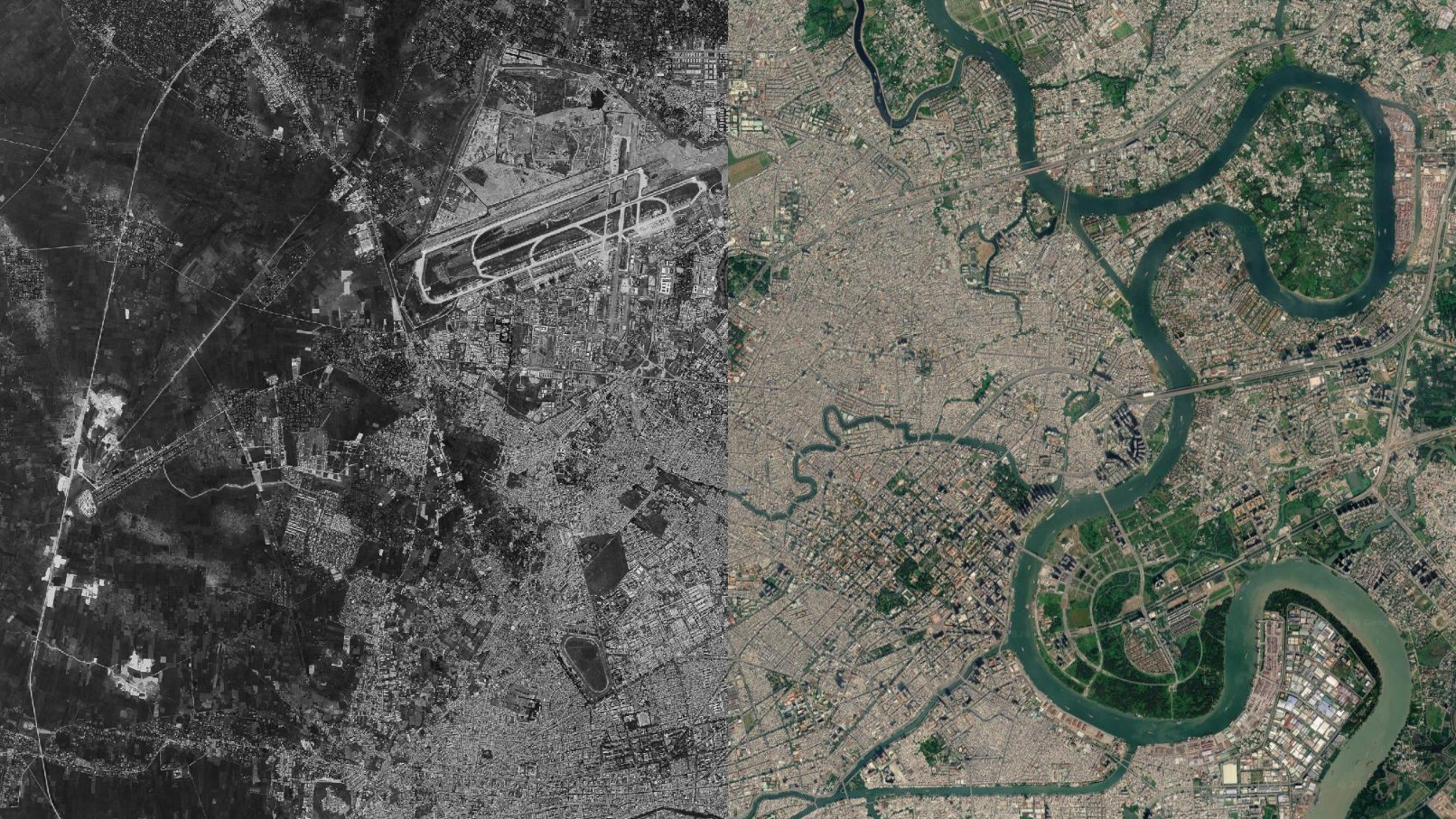
Today the same area is estimated to be home to over 10 million people. The sprawl extends in every direction, rivers have been built around, and the skyline is unrecognisable. The transition from Saigon to Ho Chi Minh City isn’t just a name change, it’s visible from space.
2. Hong Kong / Shenzhen - 1964 vs Today
KH-4A CORONA image, November 25, 1964
The 1964 CORONA frame shows Hong Kong’s dense urban core, but just across the border to the north, where Shenzhen now stands, there is almost nothing. A handful of small settlements, farmland, and the Shenzhen River marking the boundary.
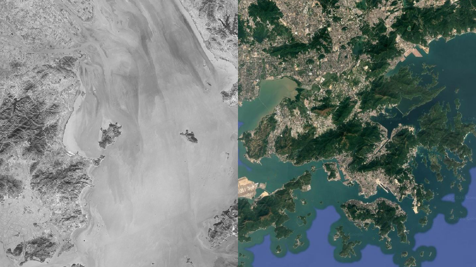
Shenzhen was officially designated a Special Economic Zone in 1980. By the time the Cold War ended, it had already become a major city. Today it has a population of over 18 million. The entire transformation happened after this image was taken, in just over 40 years.
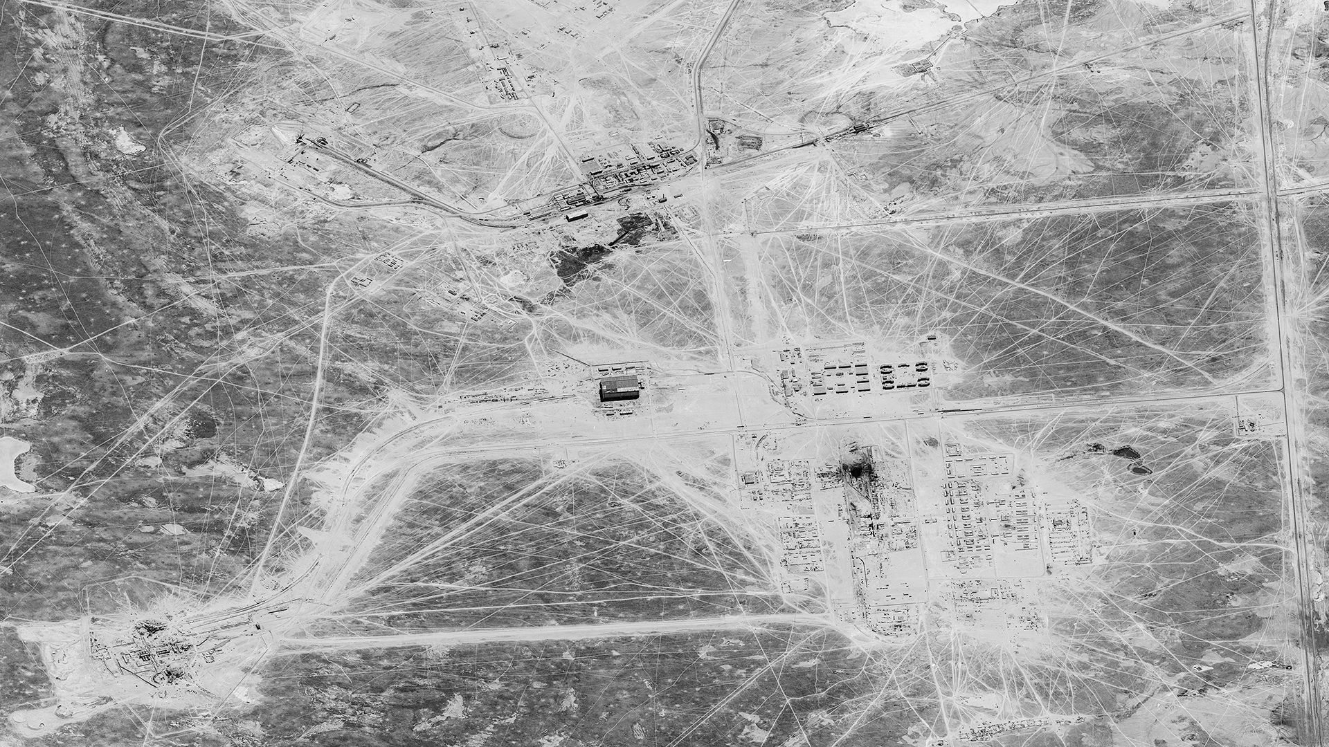
3. Chernobyl, Ukraine - 1974 vs Today
KH-9 HEXAGON image, January 6, 1974
The 1974 image shows the Chernobyl site 12 years before the disaster, the reactor complex under construction, the town of Pripyat beginning to take shape beside it, surrounded by Ukrainian forest and farmland. It looks like any other Soviet industrial project.
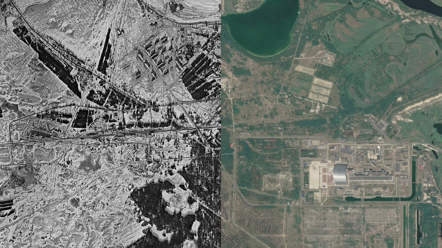
On April 26, 1986, Reactor 4 famously exploded. The exclusion zone established in the aftermath covers over 2,600 km². Modern satellite imagery shows the concrete sarcophagus, the abandoned city of Pripyat being reclaimed by forest, and an eerie stillness where a working town once stood. The spy satellite caught it before any of that was imaginable.
4. Santiago, Chile - 1972 vs Today
KH-9 HEXAGON image, December 12, 1972
This image was taken nine months before the military coup of September 11, 1973 that overthrew Salvador Allende. The city shows its mid-century layout, a contained urban grid against the Andes, with open land to the south and west.
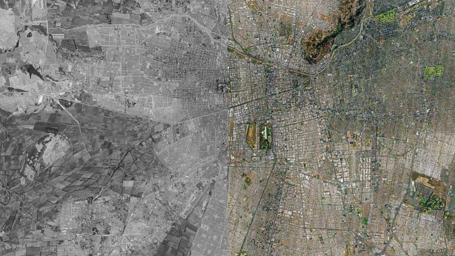
Santiago today is South America’s fifth-largest metropolitan area, with a population approaching 8 million. The city has expanded far beyond what’s visible in the 1972 frame, absorbing surrounding towns and pushing into the foothills. What the spy satellite photographed is almost unrecognisable against the modern map.
All four images are available to explore in the declassified imagery archive. The collection spans 24 years from the CORONA, GAMBIT, and HEXAGON programs with over 700 images and counting.